
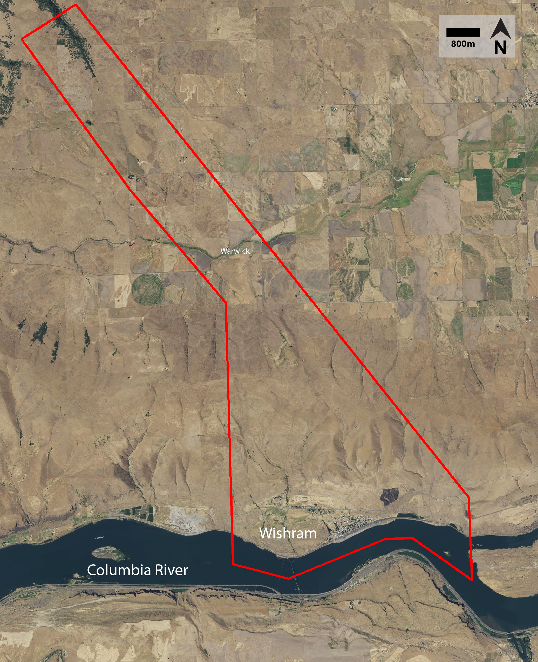
To orient you, here (below) is a figure outlining the extent of my map area in red. You may be asking yourself - why are you interested in this area? Why would the USGS fund geological mapping of this area? What makes it so cool? These are all excellent questions and so I've decided to write this post explaining the structural geology of the area and what we, as structural geologists, know and don't know about the area?..
First off, there are a couple basic terms I'd like to define. Mainly, I?m interested in locating faults in the map area. The geologic term, fault, is defined in the American Geosciences Institute Glossary of Geology as “a discrete surface of zone of discrete surfaces separating two rock masses across which one mass has slid past another”. In other words, a fault is a break or a planar fracture in the land surface (or in a volume of rock) across which there has been displacement as a result of the rock movement (below, left). As geologists, we are interested in faulting and related deformation because earthquakes can be generated along faults when they ‘rupture’, ‘break’, ‘slip’, or ‘move’. This information is important because it helps us predict and understand earthquake hazard potential. To do this we need to understand where exactly these structural features are in relation to populated community centers so city managers and engineers can effectively plan when constructing or fixing building. The structural relationship of faults to other tectonic structures, the rate at which these structures have moved in the past, and how likely they are to move in the future, all make up an essential list of geological information that help to inform and prepare nearby communities.
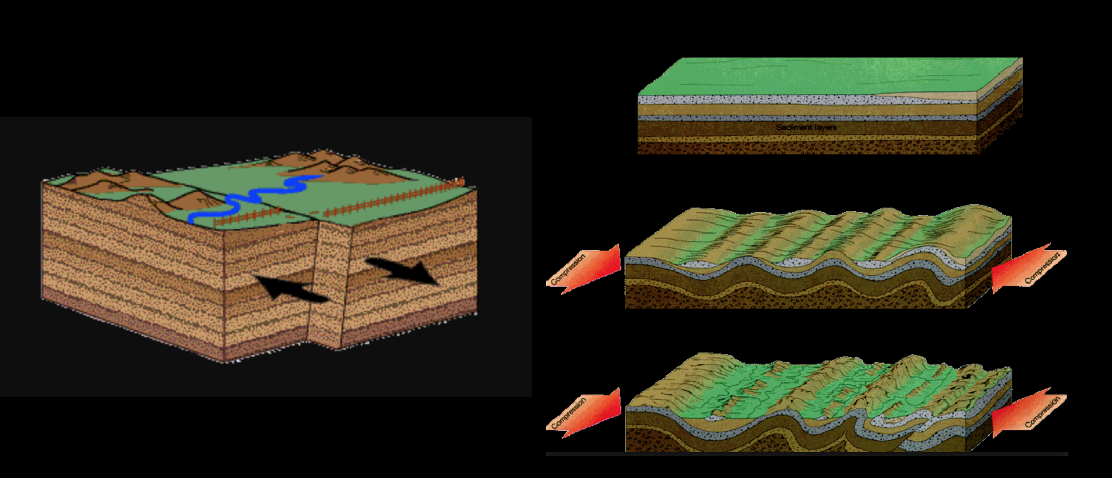
The second important feature I will look at this summer are called folds (above, right). Folds, which are curves or bends of planar structures in the subsurface, are useful to study at the surface, because they form by deformation at depth. The manifestation of folds at the surface can lend information to the deformation happening below the surface!
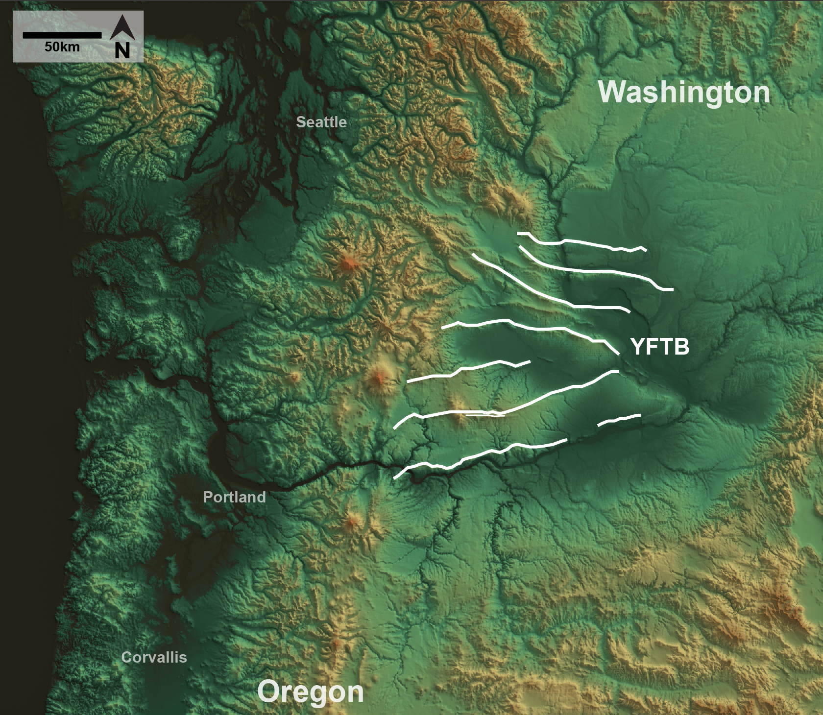
My map area contains a portion of a fold called the Columbia Hills Anticline, which is part of a large set of structures called the Yakima Fold and Thrust Belt (YFTB). The YFTB is manifested on the surface as east- to west- striking structural highs/folds caused by high-angle faults at depth. The figure (below) highlights an overview of the YFTB location in the Pacific Northwest. The white lines in the figure outline the east- to west-trending folds and faults of the YFTB. The structures of the YFTB primarily deform the Columbia River Basalt Group (CRBG) flows and overlying deposits.
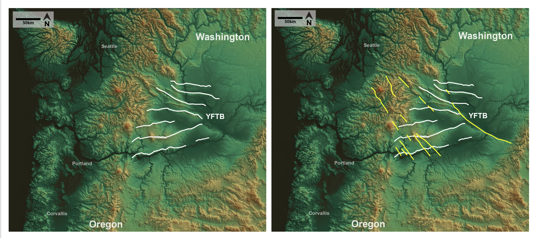
Okay, so why do we care in the Columbia River Gorge? Well, it gets more interesting! The folds and thrust faults of the YFTB are cross-cut in many areas by a series of northwest-striking, strike-slip faults. A strike-slip fault is a fault where the component of movement is parallel to the faults horizontal orientation, meaning the masses of rock on either side of the fault line basically slide against each other rather than slide one over the other. The strike-slip faults located in the YFTB are highlighted in yellow in the right figure (below). This figure is shown next to the figure that only includes YFTB folds in white for your comparison.
Here's the bottom line - geologists do not really understand the relationship between the YFTB fault-related folds and this unusual series of strike-slip faults. Why are the strike-slip faults there? What controls their geometry? Did they begin to deform when the YFTB folds began to deform? Are these strike-slip faults activating the faults beneath the folds? These are all big questions that can be solved with the help of detailed geologic mapping! I'm looking at the interaction between the Columbia Hills Anticline and a NW-trending strike-slip fault known as the Warwick Fault. My map area basically covers the extent of the Warwick fault as it crosses the anticlinal fold. The figure (below) outlines the Columbia Hills Anticline (labelled) and the Warwick Fault (yellow, labelled), just so you can orient yourself structurally.
What will I do to investigate these structures?
Initially, I will be taking as many structural measurements on the fold and on the broken rocks around the strike-slip fault. These measurements will be collected by Marina and I in the field with Brunton compasses! I will also continue mapping with the aide of publicly available LiDAR data. Finally, after I finish my map, I will draft multiple geologic cross-sections through the fold and other structures to elucidate their geometry and characteristics beneath the ground (that's the fun part)! If you would like a tutorial by OSU on how to make a geologic cross-section using a geologic map, visit this link.
Once I've finished mapping and analyzing samples, hopefully I will be able to explain the slip rate of the strike-slip fault and the relationship between this large, regional strike-slip fault and the Columbia Hills Anticline. This information will hopefully provide new insights on the regional tectonics and associated regional seismic hazard from the crustal faults in the YFTB.
Post written by Danielle Woodring, edited by Logan Byers, 2018-08-10